TSTool / Command / WriteTableToShapefile
Overview
The WriteTableToShapefile command writes a table to an Esri Shapefile,
which is a spatial data format that can be viewed in geographic information system (GIS) software and other visualization tools. See:
The table must include columns for longitude and latitude or a column containing Well Known Text (WKT) geometry strings. See:
Currently only point and polygon data can be processed but in the future support for well-known text for other geometry types will be added. A future enhancement of this command will allow the geometry feature data to be read from an existing shapefile or other standard spatial data format.
Command Editor
The following dialog is used to edit the command and illustrates the syntax of the command.
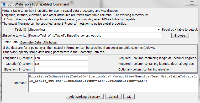
WriteTableToShapefile Command Editor (see also the full-size image)
The following figure illustrates the command syntax for layers specified with a geometry data column.
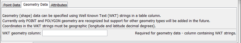
WriteTableToShapefile Command Editor for Geometry Data Parameters (see also the full-size image)
The following figure illustrates the command syntax for specifying columns to include as attributes.
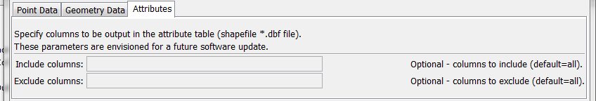
WriteTableToShapefile Command Editor for Attribute Parameters (see also the full-size image)
Command Syntax
The command syntax is as follows:
WriteTableToShapefile(Parameter="Value",...)
Command Parameters
| Parameter | Description | Default |
|---|---|---|
TableID |
Identifier for the table to write. Can be specified using ${Property} notation. |
None – must be specified. |
OutputFile |
The name of the shapefile file to write, as an absolute path or relative to the command file location. Can be specified using ${Property} notation. |
None – must be specified. |
LongitudeColumn |
The name of the table column that contains longitude. | None – must be specified. |
LatitudeColumn |
The name of the table column that contains latitude. | None – must be specified. |
ElevationColumn |
The name of the table column that contains elevation. | Elevation is omitted. |
WKTGeometryColumn |
The name of the table column that contains Well Known Text (WKT) geometry strings. | |
IncludeColumns |
List of column-separated table column names to include as attributes. Currently not enabled. | Include all columns. |
ExcludeColumns |
List of column-separated table column names to exclude as attributes. Currently not enabled. | Include all columns. |
Examples
See the automated tests.
The following example illustrates a CSV table that specifies WKT for points (see WKTGeometry column):
"ID","ID_text","Lon","Lat","Name","WKTGeometry"
50263,050263,-105.891940,38.993330,ANTERO RSVR,POINT (-105.891940 38.993330)
50454,050454,-105.476670,39.404720,BAILEY,POINT (-105.476670 39.404720)
50848,050848,-105.266670,39.991940,BOULDER,POINT (-105.266670 39.991940)
The following example illustrates a CSV table that specifies WKT for polygons:
"ID","ID_text","Lon","Lat","Name","WKTGeometry"
50263,050263,-105.891940,38.993330,ANTERO RSVR,"POLYGON (-105.891940 38.993330,-106 39,-106 37.5)"
50454,050454,-105.476670,39.404720,BAILEY,"POLYGON (-105.476670 39.404720, -104 39, -103 37.5)"
Troubleshooting
See Also
WriteTableToGeoJSONcommandWriteTableToKmlcommand